Automatic Identification System (AIS) is an automatic tracking system that utilizes transponders on ships and is employed by vessel traffic services (VTS). When satellites are used to detect AIS signatures, the term Satellite-AIS (S-AIS) is used. AIS information supplements marine radar, which continues to be the primary method of collision avoidance for water transport.
AIS
AUTOMATIC IDENTIFICATION SYSTEM
Automatic Identification System (AIS) is an automatic tracking system that utilizes transponders on ships and is employed by vessel traffic services (VTS). When satellites are used to detect AIS signatures, the term Satellite-AIS (S-AIS) is used. AIS information supplements marine radar, which continues to be the primary method of collision avoidance for water transport.
It is a shipborne transponder system capable of continuously broadcasting information about the ship using the VHF Marine band.
Objectives:
1) Safety of life at sea.
2) Safety and efficiency of navigation.
3) Coastal surveillance.
4) Protection of the marine environment.
Range: 20-50 Nm depending on antenna height.
AIS operates primarily on two dedicated frequencies or VHF channels:
1) AIS 1: Works on 161.975 MHz – Channel 87B (simplex for ship-to-ship communication).
2) AIS 2: Works on 162.025 MHz – Channel 88B (duplex for ship-to-shore communication).
It utilizes Self-Organized Time Division Multiple Access (SOTDMA) technology to achieve high broadcast rates. However, this frequency has a limitation of line-of-sight communication, approximately 40 miles.
Limitations of AIS:
1) The accuracy of received information is dependent on the accuracy of the AIS information transmitted.
2) The position received on the AIS display might not refer to the WGS 84 datum.
3) Overreliance on AIS can lead to complacency on the part of the officer on watch.
4) Users must be aware that erroneous information might be transmitted by AIS from another ship.
5) Not all ships are equipped with AIS.
6) The officer on watch must be aware that AIS, if fitted, can be switched off by certain vessels, resulting in a lack of navigational information received from those ships.
7) It may not be prudent for the officer on watch to assume that the information received from other ships is fully accurate and precise as what might be available on their own vessel.
Advantages of AIS over Radar:
1) No target swapping.
2) No blind sector.
3) Not affected by weather.
4) Real-time data with no delay.
5) Identification of targets with additional detail.
Data Transmitted:
Ship’s Data Content:
Static Information – Set during installation and transmitted every 6 hours on request.
1) Name, Call Sign.
2) IMO, MMSI Number.
3) Length, Beam.
4) Location of position fixing antenna.
Dynamic Information:
Dependent on speed and course alterations, automatically updated.
1) Position, UTC Time.
2) Course Over Ground (COG), Heading.
Manual Entry:
Navigational Status (Underway, at Anchor, NUC, Aground).
Voyage-Related Information (updated every 6 minutes, when data is amended, or on request).
– Ship’s draft.
– Hazardous cargo.
– Destination and Estimated Time of Arrival (ETA).
– Route plan (at the master’s discretion).
– Number of persons on board.
Short Messages:
Can be sent to specified ships or all ships, relevant to the safety of navigation. Typically short messages sent by UTS (Universal Time Coordinated).
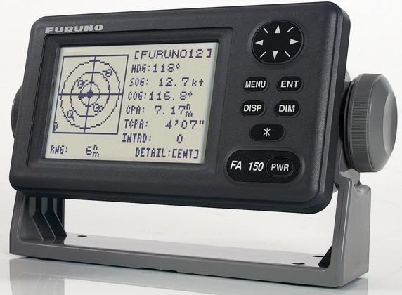
Graphical Display:
Different target states indicated by various symbols on the display.
– Sleeping target: Only presence of the vessel indicated.
– Activated target: Vector and heading information.
– Selected target: Closest Point of Approach (CPA) and Time to CPA (TCPA) values.
– Lost target: Preset range alarm will be given.
Report Rate:
State and buoy-related data reported every 6 minutes or on request (AIS responds automatically without user action).
Dynamic information depends on speed and course alterations:
– At anchor: 3 minutes.
– Underway, NUC (Not Under Command), and Aground: 10 seconds.
– All other cases: 6 seconds.
In conclusion, Automatic Identification System (AIS) is a valuable technology used for vessel tracking and collision avoidance in the maritime industry. It provides real-time data about ships, their positions, and other relevant information to enhance safety and efficiency in navigation. While AIS has limitations, such as the accuracy of transmitted information and the potential for erroneous data, it offers advantages over radar in terms of target identification, real-time data, and resistance to weather interference. AIS plays a crucial role in ensuring the safety of life at sea, promoting efficient navigation, coastal surveillance, and protecting the marine environment.