MERCATOR SAILING
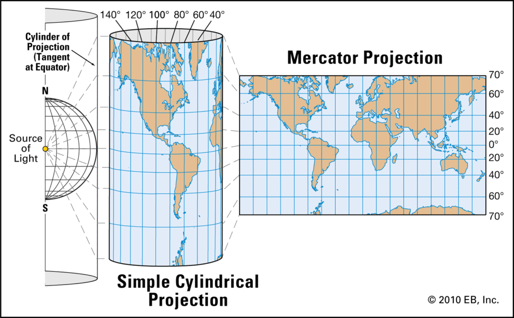
As we know from the last chapter Mercator projection is a projection of the Earth on a flat plane. Mercator sailing is done on the Mercator chart where the distance between latitudes is not the same and the meridians are parallel lines at equal distance to each other. The Mercator sailing triangle consists of DMP, D’long and distance. This helps us to find the Rhumb line course and distance by the following formulas –
D’long/DMP = tan course
Distance = d’lat*sec course

MIDDLE / MEAN LAT SAILING
Middle latitude can also be referred to as the true departure. Hence after substituting is the parallel sailing formula –
Dep = d’long*cosine middle latitude
Tan course = true departure/d’lat
Distance = d’lat*sec course or,
Distance = true departure*cosec course
TRANSVERSE TABLE
The Transverse tables are used to solve plain sailing problems for a distance up to 600 miles and for each degree of course angle from 0 degrees to 90 degrees just by observing the data in the table.
DAYS WORK
Days work is the calculations made by a mariner to find the distance, speed and course made good by a vessel when it is involved in steering a number of courses and distances i.e. when it follows an irregular track. It is done from noon till noon of the other day ( noon to noon).
Some of the other components of days work are –
- Dead Reckoning (DR) – It is the position obtained by applying course, speed and duration of time to the initial position.
- Leeway – It is the effect of wind that causes bodily movement of the ship leewards. It is the angle between wake of the ship and fore and aft line of the ship.
- Estimated Position (EP) – It is the position obtained after applying the true course, distance by log and effects of wind and current.
- Fix – it is the actual position of the ship.
- Set – It is the angle by which the fix is deviated from the DR position.
- Drift – It is the distance by which fix is deviated from the DR position.
- Current – Current is the non-tidal horizontal movement of the sea due mainly to meteorological, oceanographical, or topographical causes.
- Tidal Stream– A tidal stream is tidal horizontal movement of the sea due to tide-raising forces of the Sun and the Moon.